


Source: Courtesy of Wikimedia Commons
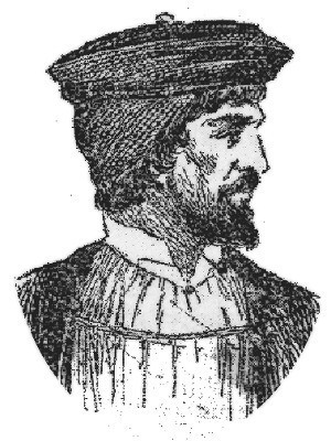
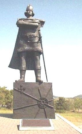
CORTE-REAL, GASPAR, Portuguese explorer; b. c. 1450–55.
The third son of João Vaz Corte-Real, governor of the southern half of Terceira Island and of St. George Island in the Azores, Gaspar is mentioned in several documents as acting governor during the absence of his father in 1488 and of his elder brother in 1497.
In 1498, King Manoel of Portugal (1495–1521) manifested an interest in western exploration, for the probable reason that the land discovered in the previous year by John Cabot was thought to fall within the territory assigned to Portugal by the treaty of Tordesillas [signed 7 June 1494 between Spain and Portugal to settle conflicts arising from Columbus’s first voyage]. During the next four years, Pedro de Barcelos, João Fernandes “Labrador,” the brothers Gaspar and Miguel Corte-Real, and João Martins (all prominent residents of Terceira Island) took part in the search for land across the North Atlantic. Martins, indeed, had been a criado (employee) of João Vaz Corte-Real, Gaspar’s father.
The first Portuguese discovery occurred in 1500, when Gaspar sighted “Ponta d’Asia” (Greenland), in the probable vicinity of Cape Farewell. He was, however, prevented from landing, either by the ice floes or by the weather. According to Biggar (Voyages, 88–91), the Portuguese rounded the southern tip of Greenland and entered Davis Strait, exploring the west coast as far as Sukkertoppen in 65° 20´. Positive evidence that the Portuguese penetrated that far north is, however, lacking. Biggar relies on some very doubtful statements published by Damian de Goes in 1566, more than 60 years after the voyage was made, in which he mentions that the explorers saw white bears and natives who looked like Laplanders. Damian de Goes, it would seem, has confused the 1500 voyage with that of 1501.
A different view of the 1500 voyage is given by Henry Harrisse (Discovery, 50, 61–62). After sighting Greenland, he thinks, the Portuguese crossed Davis Strait, landing somewhere on the east coast of Newfoundland, possibly in the vicinity of Notre-Dame Bay. Gago Coutinho, the Portuguese admiral, has put forward a very bold theory in a recent study (Ainda Gaspar Corte-Real, 29–30), namely that Gaspar Corte-Real, after coming within sight of Greenland, was unable to land there but reached Newfoundland. He sailed around the island and penetrated into the Gulf of St. Lawrence by the northern route (Belle Isle strait), coming out through Cabot Strait. The latter theory, ingenious though it is, is not backed by documentary evidence. Our only positive information about the Portuguese voyage of 1500 is derived from a legend on the Cantino map, which states that the Portuguese sighted Greenland – mistakenly taking it to be East Asia – but were unable to land there. Any other theory is pure conjecture.
In 1501 Gaspar made another voyage with three caravels. There is a fair amount of information about this new undertaking in three letters written from Lisbon by Pietro Pasqualigo and Alberto Cantino in October 1501. These letters reveal that the expedition first tried to reach the land sighted the previous year. Finding the sea frozen, the Portuguese were forced to change course and, after apparently crossing the entrance to Davis Strait, they found a coast where many large rivers flowed into the sea. They sailed up one of these estuaries for about one league and disembarked in a country where pine trees and wild berries grew. They also captured a number of natives.
In the view of H. P. Biggar, the Portuguese had entered Hamilton Inlet, “which they explored as far as the Narrows, 35 miles up, where the breadth is only one third of a mile” and he identifies the aborigines brought back to Portugal as “Nasquapee Indians who still inhabit Labrador” (Biggar, Voyages, 96–97, 100). Harrisse, on the other hand, believes that the land of large rivers, tall pines, and wild berries described by Cantino must be the east coast of Newfoundland, where there are huge forests and streams of considerable size, like the Gander and the Exploits (Harrisse, Discovery, 69).
Gago Coutinho noted that the natives brought back to Portugal seemed to belong to two varying climatic regions, since some were dressed in skins, while others were naked. He concludes that Gaspar had explored two different sections of the American coast, one in Newfoundland and the other much farther to the south (Coutinho, Corte-Real, 30–32). Coutinho’s deductions may contain some elements of truth but he is wrong in his assumption that Gaspar reached America by the southern route and that he explored the coast all the way from Florida to Newfoundland, for he could not then have found the sea frozen on his way to America. It is much more logical to suppose that Gaspar, if he discovered a temperate land, must have done so by sailing south from Newfoundland.
Two of Gaspar’s three ships returned to Lisbon in October 1501 but the third, with the leader of the expedition, was lost, never to be heard from again. (See Miguel Corte-Real for his attempt in 1502 to find his lost brother, Gaspar.)
The land discovered by Gaspar appears for the first time on the Cantino map (1502) as the “Terra del Rey de Portugall.” Other maps picturing it are those known as Kunstmann II and III (“Terra de Corte Real”). What is the exact location of the territory and how far north did it extend?
It is generally believed that it included the eastern shore of Newfoundland. On the Pedro Reinel map known as Kunstmann I, the new land is given an extension of 10° in latitude, from 49°N to 57°N. This has led Heinrich Winter and Ellen Taylor to believe that “Corte-Real Land,” which also became known as “Codfish Land,” extended far beyond the Strait of Belle Isle, as far as Cape Chidley.
It is true that the configuration of the coast on Reinel’s map, as well as on other maps, seems to comprise present-day Labrador, in addition to eastern Newfoundland, but this is probably the result of later exploration. This author, however, doubts that the Corte-Reals sailed as far north as Cape Chidley, since Antonio Galvão states that Gaspar struck land at a latitude of 50°N and since the coast discovered by the Portuguese extended only from Cape Race to Bonavista, according to Pierre Crignon (see Ramusio, Terzo volume delle navigationi et viaggi, 417, 423–24).
It is possible, of course, that Reinel may have embodied in his map other data than those derived from the Corte-Real voyages. As soon as Newfoundland became known, vessels from England, France, Spain, and Portugal quickly established new fishing grounds. As early as 1506, for example, a tithe on Newfoundland fish was levied in Portuguese ports by order of the king. Reinel may have obtained considerable information from pilots of fishing vessels which may have ventured up Davis Strait. His map is undated but may have been drawn as late as 1510.
Alguns documentos do Archivo National da Torre do Tombo (Lisboa, 1892), 123–27, 131–32, 150–52. Antonio Galvão, Tratado dos descobrimentos (Porto, 1944), 149. Damiano de Goes, Chronica do felicissimo rei dom Manuel (Lisboa, 1566), ff.65–66. Raccolta Colombiana (Roma, 1892), pt.iii, v.I, 87–90, 151–52. G. B. Ramusio, Terzo volume delle navigationi et viaggi nel quale si contengono Le Navigationi al Mondo Nuovo (1st ed., Venetia, 1556), 417, 423–24.
H. P. Biggar, The voyages of the Cabots and of the Corte-Reals to North America and Greenland, 1497–1503 (Paris, 1903). Gago Coutinho, Ainda Gaspar Corte-Real (Lisboa, 1950). Henry Harrisse, The discovery of North America: a critical, documentary, and historic investigation, with an essay on the cartography of the new world . . . (London, 1892), 59–76; Les Corte-Real. Hoffman, Cabot to Cartier, 26–29. S. E. Morison, Portuguese voyages to America in the fifteenth century (Cambridge, Mass., 1940), 68–72. Oleson, Early voyages, 143–44. Precursors (Biggar), 32–40, 59–70, 92–98. E. G. R. Taylor, “Hudson’s Strait and the oblique meridian,” Imago mundi, III (1939), 48–52. Heinrich Winter, “The pseudo-Labrador and the oblique meridian,” Imago mundi, II (1937), 61–74.
Maps: Friedrich Kunstmann, Atlas zur Entdeckungsgeschichte Amerikas (München, 1859), charts I-IV. Portugaliae monumenta cartographica, comp. A. Cortesão et A. Teixeira da Mota (5v., Lisboa, 1960–62), I, plates 4, 5, 6, 8.
© 1966–2024 University of Toronto/Université Laval
Image Gallery
Related Biographies

CABOT, JOHN

CARTIER, JACQUES (1491-1557)
Cite This Article
L.-A. Vigneras, “CORTE-REAL, GASPAR,” in Dictionary of Canadian Biography, vol. 1, University of Toronto/Université Laval, 2003–, accessed April 23, 2024, http://www.biographi.ca/en/bio/corte_real_gaspar_1E.html.
The citation above shows the format for footnotes and endnotes according to the Chicago manual of style (16th edition). Information to be used in other citation formats:
| Permalink: | http://www.biographi.ca/en/bio/corte_real_gaspar_1E.html |
| Author of Article: | L.-A. Vigneras |
| Title of Article: | CORTE-REAL, GASPAR |
| Publication Name: | Dictionary of Canadian Biography, vol. 1 |
| Publisher: | University of Toronto/Université Laval |
| Year of publication: | 1966 |
| Year of revision: | 1979 |
| Access Date: | April 23, 2024 |