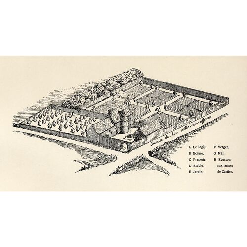
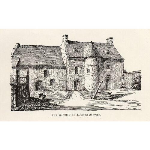
CARTIER, JACQUES, navigator of Saint-Malo, first explorer of the Gulf of St. Lawrence in 1534, discoverer of the St. Lawrence River in 1535, commander of the settlement of Charlesbourg-Royal in 1541–42; b. probably some time between 7 June and 23 Dec. 1491 at Saint-Malo (Brittany), where he died in 1557.
Cartier had no doubt been going to sea since his youth, but nothing is known of his career before 1532. According to Lanctot, Cartier may have taken part in Verrazzano’s expeditions in 1524 and 1528. Cartier’s absences from France which coincide with the voyages of the celebrated Florentine, the objective assigned to Cartier in 1534, his point of arrival in Newfoundland which corresponds to the final point reached on the 1524 voyage, a Danish map of 1605, and a statement of the Jesuit Pierre Biard in his Relation for the year 1614 – from all these Lanctot concludes that Cartier sailed along the North American coast in 1524. He further states that Cartier, after Verrazzano’s death, took command of the ship to return to France.
Several objections militate against this theory: if Cartier was absent from Saint-Malo during Verrazzano’s voyages, he could easily have been elsewhere than on the Dauphine; moreover the expedition set out from Normandy, and one can hardly imagine a Breton joining forces, at that time, with the shipowners of Dieppe. Why does Cartier, in the accounts of his travels, never allude to Verrazzano or to the coast visited in 1524? When he compares the natives or the produce of Canada with those of Brazil, why does he never mention those of the North American seaboard? If Cartier had an important post on board the Dauphine, why does his name not appear in the Verrazzanian toponymy which recalls so many of the people associated with the Florentine? Finally, why do the French maps which rely upon Cartier for the valley of the St. Lawrence reject the Verrazzanian toponymy and utilize systematically the Spanish one? Lanctot’s thesis is interesting, although it remains unproven and adds nothing certain to our knowledge of Cartier.
When in 1532 Jean Le Veneur, bishop of Saint-Malo and abbot of Mont-Saint-Michel, suggested to François I that an expedition be sent to the New World, he asserted that Cartier had already been to Brazil and to “Newfoundland.” In fact Cartier’s accounts do include several allusions to Brazil which are not merely recollections of things read; as for Newfoundland, Cartier knew the surrounding regions: a month before his departure he was aware that he was expected to reach the “Baie des Châteaux” (Strait of Belle-Isle), and he went directly there as if it were a familiar stopping-place.
The commission granted to Cartier in 1534 has not been located, but an order from the king, in March of the same year, enlightens us as to the objective of the voyage: “to discover certain islands and lands where it is said that a great quantity of gold, and other precious things, are to be found.” The 1534 account suggests a second objective: the route to Asia. To those who credit Cartier, on this first voyage, with a concern for missionary work, Lionel Groulx’s answer is: “Gold, the gateway to Cathay! If there is a mystique in all this, to use a word which is so debased today, it is a mystique of merchants, behind which looms a political rivalry.” The 1534 account mentions no priest engaged in evangelization among the natives; it would moreover have been useless, because of the linguistic barrier. Although the ship’s muster-roll has not been found, one may surmise that at least one priest was on board; when Bishop Le Veneur had proposed Cartier he had undertaken to supply the chaplains, and the account of the voyage alludes to the singing of mass.
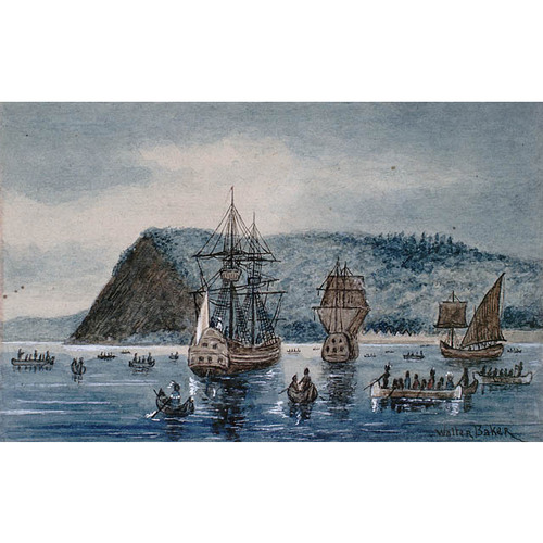
Cartier set off from Saint-Malo on 20 April 1534, with 2 ships and 61 men. Favoured by “good weather,” he crossed the Atlantic in 20 days. He visited places already known and named, from the cape of “Bonne Viste” to the Baie des Châteaux; then he entered the bay which had been set as the first stage in his journey. Ten leagues away, in the interior, was the port of Brest, a depot for supplying the codfishermen with water and wood. One hundred miles to the west of Belle-Isle, Cartier encountered a ship from La Rochelle; he directed it back on to its course. Cartier was not yet in a totally unknown world, but he freely assigned names to the geographical features of the north coast: Île Sainte-Catherine; Toutes-Isles; Havre Saint-Antoine; Havre Saint-Servan, where he set up his first cross; Rivière Saint-Jacques; Havre Jacques-Cartier. For the land which he saw he had the utmost contempt: “along the whole of the north shore, I did not see one cart-load of earth,” it was “the land God gave to Cain.” On 15 June he steered “towards the south” and entered unexplored regions. He went along the west coast of Newfoundland, distributing French names, and reached what is today Cabot Strait, but he did not perceive that it was a navigable channel and turned westward.
He came across islands which appeared fertile to him by comparison with Newfoundland, among them Île Brion where he perhaps set up another cross, and on 26 June he reached the Îles de la Madeleine, which he assumed to be the beginning of the mainland. On the evening of 29 June he sighted another land, “the best-tempered region one can possibly see, and the heat is considerable”; he had discovered Prince Edward Island, without however being able to determine that it was an island.
Next, he explored bays that were disappointing, openings that held continual promise of being the passage to Asia, but which grew narrower as he advanced. To the southern tip of the “baye de Chaleurs” he gave the name of Cap d’Espérance, “for the hope we had of finding here a strait.” From 4 to 9 July he made a systematic investigation, only to conclude that no passage existed, “whereat we were grieved and displeased.” On 14 July he entered the Baie de Gaspé (which remained unnamed in 1534). He stayed there for a considerable time, until 25 July, which permitted him to establish some very important contacts with the Indians.
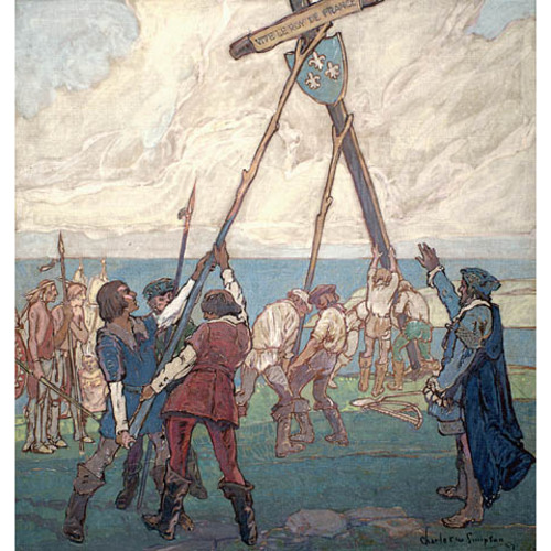
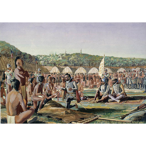
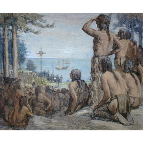
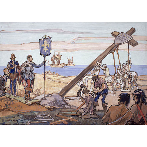
They were not the first natives whom he had encountered. On 12 or 13 June he had seen Indians in the “land of Cain”; they had come from inland to hunt the seal, and they have been identified by some as Beothuks, who are now extinct. At the beginning of July he had seen others on the Prince Edward Island coast, and on 7 July, in the Baie des Chaleurs, he had traded in furs with natives, probably Micmacs. Those whom he met at Gaspé were Laurentian Iroquois, who had come down in great numbers for their annual fishing. This nation was master of the St. Lawrence and was to assume historical importance. The Iroquois gleefully accepted small gifts, and an alliance was concluded, with dancing and jubilation. On 24 July Cartier erected a cross 30 ft. high, bearing the arms of France, at Penouille Point. If the crosses at Saint-Servan and on Île Brion were rather in the nature of landmarks or beacons, this one was much more: it is clear from the importance of the ceremony that the cross was intended to indicate that the territory was being taken possession of in the name of François I. Chief Donnacona protested; he approached Cartier’s boat with his brother and three of his sons to harangue the strangers. A pretence was made of offering him an axe. As he was about to take it, the French held on to his craft and forced the Iroquois to come on board the ship. Cartier reassured them and obtained permission to take away with him two of Donnacona’s sons, Domagaya and Taignoagny, promising to bring them back. There was feasting, followed by a most cordial leave-taking. Cartier left the Baie de Gaspé on 25 July with these two Indians, who would be able one day to act as interpreters.
He could have turned westward, but he turned eastward, thinking that the strait 40 miles wide between the Gaspé Peninsula and Anticosti was nothing more than “the coast [which] ran back forming a bay, in the shape of a semi-circle.” Cartier therefore missed discovering a river which would have taken him a long way into the interior of the continent. Until 29 July he sailed along the coast of Anticosti Island, and then around it; he took it for a peninsula. From 1 to 5 August he tried to find out whether he was in a bay or a waterway, and he finally realized that “the coast began to turn off towards the south-west.” Once again he had all but discovered the river, but bad weather intervened, and Cartier decided to withdraw. After meeting some Montagnais at Natashquan point, he set his course straight for Newfoundland, and on 15 August started on the trip home.
Cartier had been the first to go right round the gulf. Perhaps John Cabot, the Corte-Reals, and João Alvares Fagundes had seen it before him, but no document offers any proof. Cartier discovered the gulf, he drew a map of it, and he had caught a glimpse of the hinterland. True, his geographical knowledge was limited; he did not notice the passage between Newfoundland and Cape Breton, he thought the Îles de la Madeleine were the mainland, he did not discover the entry to the river. For Cartier, this sea possessed only one certain outlet, the Strait of Belle-Isle, and another possible one, to the north of Anticosti, which he did not have time to investigate.
The discovery of an inland sea, the exploration of a new country, an alliance with natives from the west, the immediate possibility of penetrating deeper, the assistance of two Indians who were learning to express themselves in French, all this made a second expedition worth while, even if Cartier had so far found neither gold nor metals. He was back in Saint-Malo on 5 Sept. 1534, and as early as 30 October he received a new commission to complete his discovery, François I paying 3,000 livres towards the undertaking.
In 1534 Cartier had had only 2 ships and 61 men; in 1535 he had 3 ships and a crew of some 110 men. On board the Grande Hermine, Cartier had the shipmaster Thomas Fromont as his assistant; he took with him Claude de Pontbriand (son of a Seigneur de Montréal, in Languedoc), Charles de La Pommeraye, Jehan Poullet, thought to be the author of the account of the second voyage, and a few gentlemen. Guillaume Le Marié sailed the Petite Hermine under the command of Macé Jalobert; the captain of the Émérillon was Guillaume Le Breton Bastille and the navigator Jacques Maingart. The undertaking had brought together numerous relatives of Cartier and of his wife Catherine Des Granches: Étienne Noël, a nephew; Macé Jalobert, a brother-in-law; Antoine Des Granches, Jacques Maingart, and three other Maingarts; Michel Audiepvre; Michel Philipot; Guillaume and Antoine Aliecte; and Jacques Du Bog. Were there any chaplains? The ship’s muster-roll mentions dom Guillaume Le Breton, and dom Anthoine immediately following. The word “dom” was at that time applied only to secular priests, unless it is here the abbreviation for “Dominique.” Religious ceremonies were indeed performed on this voyage, but when Donnacona and his people asked for baptism (at a moment which it is difficult to specify), Cartier replied that he expected to bring priests with him on another voyage. Perhaps dom Le Breton and dom Anthoine were already dead? It is quite natural that chaplains should have accompanied such a large expedition, but no real proof of their presence can be found anywhere. Domagaya and Taignoagny were on the voyage also. During their eight and a half months’ stay in France they had learned French, but had not yet been baptized.
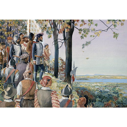
Cartier left Saint-Malo 19 May 1535 and reached the gulf once more after a long, 50-day crossing. He immediately resumed his quest, sailing along the north coast. To mark his route he set up a cross in a harbour to the west of Natashquan. He stopped in a bay which he called Saint-Laurent (now Sainte-Geneviève); the name was soon to be extended to the gulf, and then to the river. Finally, on 13 August, following the instructions of his two native guides, he passed the crucial point. There before him was the whole geography of the region: the Indians showed him “the way to the mouth of the great river of Hochelaga and the route towards Canada,” which narrowed continually as one went on; its waters, first salt then fresh, came from so great a distance that there was no record of any man ever having seen their source. Here at last, concluded Cartier, was the passage he was seeking.
He went up the river, examining the two shores as he advanced. He perceived on his right a “very deep and rapid” river which his guides told him was the route to the Saguenay, a kingdom where there was copper, and about which Donnacona was to tell wonderful tales. On 7 September Cartier reached the archipelago of Orléans, which was “where the province and territory of Canada begins,” the name Canada being applied then only to what is now Quebec. After feasting with Donnacona, Cartier decided to lay up his ships in the river Sainte-Croix (Saint-Charles), at the mouth of the stream called Lairet. Opposite rose the cape of Stadacona, where there was a village which was probably unfortified, after the Montagnais fashion, although it was inhabited by Iroquois.
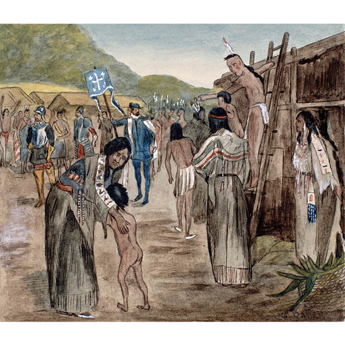
Cartier was eager to get to Hochelaga, but the two native interpreters had already begun to scheme against the French. There was also some anxiety at Stadacona about this trip. Donnacona wanted to secure for himself the monopoly of the trade which would develop, since he hoped to escape from the domination exercised by Hochelaga over the Iroquois of the valley. He tried to detain Cartier by gifts, then by a display of witchcraft. Cartier, however, set out on 19 September on the Émérillon, but without interpreters, which greatly lessened the usefulness of his trip. He stopped at Achelacy (in the region of Portneuf), and formed an alliance with the local chieftain. He reached the lake which he called “Angoulême” (Saint-Pierre), left his ship at anchor, and went on in long-boats with some 30 men. On 2 October he arrived at Hochelaga, a town enclosed and fortified after the Iroquois style, near a mountain which he named Mont-Royal. He was given a joyous reception which even took on the air of a religious ceremony; to the Iroquois, who presented their sick to be cured, Cartier read the gospel according to St. John and the Passion of Christ. Without delaying further, he visited the rapids which blocked navigation to the west. The Indians explained to him by signs that other rapids obstructed the river and that a watercourse, by which one could reach the gold, silver, and copper of the Saguenay, flowed into the river from the north. But Cartier did not pursue his investigation; he left Hochelaga the next day, 3 October. On 7 October he stopped at the mouth of the “rivière de Fouez” (Saint-Maurice), and set up a cross there.
When Cartier returned to Stadacona, he found his men building a fort. The natives feigned joy on seeing him again, but their friendliness had vanished; new intrigues by the interpreters soon brought about a complete rupture. Relations were resumed only in November, in an atmosphere of mutual distrust.
Then came winter, the Laurentian winter which the Europeans were experiencing for the first time, and which furthermore was a severe one. From mid-November to mid-April the ships were icebound. The snow reached a height of four feet and more. The river froze as far as Hochelaga. Still more terrible than the winter was scurvy, which appeared among the natives of Stadacona in December; despite an attempt to set up a sanitary barrier against it, it attacked the French. By mid-February not more than 10 of Cartier’s 110 men were still well; 8 were dead, including the young Philippe Rougemont, on whom an autopsy was made. And the evil continued its ravages; 25 persons, all told, eventually died. Cartier and his men went in a procession to pray before an image of the Virgin, and Cartier promised to make a pilgrimage to Roc-Amadour. At last, by skilfully questioning Domagaya, who had had scurvy, Cartier learned the secret of the remedy: an infusion made from annedda (white cedar). The crew was quickly cured.
Cartier was eager to use his contacts with the natives to increase his knowledge. He is the first person to give us information on the religion and customs of the St. Lawrence valley Indians. The network of waterways was moreover beginning to take shape in his mind: the Richelieu, still unnamed, which came from “Florida”; the St. Lawrence, which was open to navigation for three months; to the north of Hochelaga, a river (the Ottawa) which led to great lakes and to a “freshwater sea”; great waterways which proved that the continental barrier was much broader than had been believed. All the wonderful stories that he heard about the fabulous kingdom of Saguenay, the legend of which was perhaps a relic of Norse traditions (unless the Mississippi basin was meant), were recorded by Cartier. This continent was already extremely rich in surprises!
When spring came they prepared to return to France. As his crew was not large enough, Cartier abandoned the Petite Hermine. Her remains were thought to have been found in 1842 and one portion was deposited with the Quebec Literary and Historical Society, the other being sent to Saint-Malo. But, as N.-E. Dionne has written, it has never been proved that this wreckage was that of the Petite Hermine.
Before leaving, Cartier wanted to strengthen the position of the French; the ethnic, linguistic, and political unity of the Laurentian valley already gave them an advantage, which was however endangered by the conduct of Donnacona and of his two sons. Cartier learned that a rival, Agona, was aspiring to power. A plan for a revolution became clear: to eliminate the ruling party on behalf of Agona. Cartier cunningly took advantage of a religious ceremony – the erection of a cross on the festival on 3 May – to capture Donnacona, the interpreters, and a few other natives. He appeased the crowd by promising to bring back Donnacona in 10 or 12 months, with lavish presents from the king.
On 6 May he left Sainte-Croix with his two ships and about ten Iroquois, including four children who had been given to him the previous autumn. In his cargo were a dozen pieces of gold and some furs. This time, as he sailed between Anticosti Island and the Gaspé Peninsula, he ascertained that the Îles de la Madeleine, then called the Araines, were in fact islands, and discovered between Newfoundland and Cape Breton the passage which he had not noticed in 1534. On 16 July 1536 he arrived back in Saint-Malo, after an absence of 14 months.
This second voyage had been much more profitable than the first: Cartier had discovered a river by means of which one could penetrate deeply into the continent; he had opened up a new access route to the gulf; he had seen the natural resources of the St. Lawrence and had got to know its inhabitants; he had returned with an old chieftain who boasted of having visited the fabulously wealthy country of the Saguenay; and he had gold.
Immediately on his return Cartier presented a report to François I; he spoke of a river 800 leagues long which might lead to Asia, and he got Donnacona to add his testimony. The king enthusiastically gave him the Grande Hermine.
However, the Saint-Malo navigator could not resume his explorations immediately. War broke out between François I and Charles V; Savoy effaced the thought of America. What became of Cartier? Lanctot ascribes to him a memoir of 1538, which outlines a colonization plan, but there is no documentary proof to lend support to this argument. Similarly Lanctot has attempted to forge a dramatic link between Cartier and the escape of the Irish rebel Gerald Fitzgerald, who styled himself a king. A first report from a spy states that Cartier went to Ireland to get Fitzgerald, a version which Lanctot hastily accepts; but in a second report drawn up by the same spy after a more extensive enquiry, Cartier’s role is limited to that of welcoming the refugee to Saint-Malo.
It was not until 17 Oct. 1540 that the king gave Cartier a commission for a third voyage. The discoverer was named captain-general of the new expedition, and he was to proceed to “Canada and Hochelaga, and as far as the land of Saguenay,” with individuals of “all kinds, arts and industries,” including some 50 men whom he was authorized to take from the prisons; exploration was to be carried out, and they were to live with the natives “if need be.” Cartier made ready: he arranged to have the 50 prisoners delivered to him, he asked certain spiritual favours from Rome, and he persuaded the king to intervene to hasten the recruitment of his crew.
On 15 Jan. 1541 a royal decision changed everything; the Protestant Jean-François de La Rocque de Roberval received a commission which placed him instead of Cartier at the head of a great colonizing undertaking. Lanctot has argued that Cartier remained on an equal footing with Roberval, the one concerned with colonization, the other with navigation. Yet the text of the commission is clear: Roberval was named the king’s “lieutenant general,” the “chief, leader, captain” of the undertaking, with authority over all those who would be part of “the said undertaking, expedition and army,” and all were to take “oath of fealty” to obey him; moreover, in this commission the king annulled the one granted in October. Cartier became in truth Roberval’s subaltern.
Cartier was ready in May 1541, but Roberval had not yet received his artillery. As the king was anxious that Cartier should set sail at once, Roberval gave him “full authority to leave” and instructed him to represent him. Cartier made his will on 19 May and on 23 May put to sea with five ships, including the Grande Hermine and the Émérillon. A Spanish spy put the crew at 1,500 men. Among Cartier’s companions might be mentioned two brothers-in-law: Guyon Des Granches, Vicomte de Beaupré, and the pilot Macé Jalobert; a nephew, Étienne Noël; and the shipmaster Thomas Fromont, dit La Bouille, who was to die during this voyage. None of the Iroquois whom he had brought to France in 1536 returned to Canada; they had all died, except for a little girl.
On 23 Aug. 1541 Cartier reappeared before Stadacona. The Indians received him with numerous demonstrations of joy. Cartier announced Donnacona’s death, but stated that the other Iroquois were living in France like lords and did not want to return, which must have delighted Agona. The friendly relations nonetheless did not last. The abandonment of the Sainte-Croix site can no doubt be explained by this mutual distrust. Cartier went up the river and established himself at the western extremity of the cape, at the mouth of the Rivière du Cap-Rouge. The settlement was first called “Charlesbourg-Royal.” This site appeared much more favourable than the first one; moreover white cedar was found there, and especially stones which were thought to be diamonds (hence the name Cap aux Diamants), and “certain leaves of fine gold.”
On 2 September Cartier despatched Jalobert and Noël, with two ships, to France, to make a report; then he began two forts, one at the base of the cape, the other at the top. On the seventh he left the settlement under the command of the Vicomte de Beaupré and sailed for Hochelaga, greeting his friend the chieftain of Achelacy on the way and entrusting to him two boys so that they could be taught the language. They were the first two Europeans to become pupils of the natives. Cartier’s intention was to examine the Hochelaga rapids in order to be able to clear them the following spring. The Indians proved to be affable, as they were in 1535, but Cartier had no interpreters. He made no progress in his knowledge of the hinterland, but persisted in his hypothesis of 1535.
When he returned, Cartier noticed that the Iroquois’ distrust was increasing. Even the chieftain of Achelacy abandoned him. The French made ready to defend themselves. As the account of this voyage breaks off suddenly, we do not know exactly what happened during the winter season. We may infer from one sentence in this account that there was some scurvy, readily overcome thanks to the infusion of white cedar; according to some testimonies, the natives kept the settlement in a state of siege and boasted of having killed more than 35 Frenchmen. Cartier struck camp in June 1542.
At the port of St. John’s (Newfoundland) he met Roberval, who had finally put in an appearance with his settlers and who ordered him to turn back. Believing that he was carrying gold and diamonds with him, or not wanting to face the natives again, Cartier headed for France under cover of darkness, thus depriving Roberval of manpower and of precious experience.
Cartier’s fleet was the fleet of illusions: the gold ore was nothing but iron pyrites, and the diamonds were quartz, hence the proverb “as false as Canadian diamonds.” It is not known whether Cartier was reprimanded for his insubordination; in any case he was not given the mission of repatriating Roberval in 1543, and he was not entrusted again with any long-range expedition.
Later Cartier had to sort out his accounts from Roberval’s, and he appeared before a special tribunal in the spring of 1544. He proved that he had been a faithful trustee of the king’s money and of Roberval’s and was repaid about 9,000 livres, although certain merchants claimed in 1588 that the people of Saint-Malo had not yet received what Cartier declared that he had paid them.
In 1545 appeared the Brief récit, an account of the second voyage, published anonymously and mentioning once only in the text the name of Cartier. The navigator is said to have written in this period a “book in the nature of a sea-chart,” but it has not been discovered. He received the Franciscan André Thevet, to whom he gave extensive information about Canada. An hypothesis has been advanced according to which a meeting between Rabelais and the explorer furnished some material for Pantagruel. This hypothesis has received less and less credence, and the last critic to mention it, Bernard G. Hoffman, does not accept it at all.
From this time on, Cartier apparently concentrated upon business and upon the exploitation of his estate of Limoilou. He acted as godfather, or served as a witness at court on various occasions. Cartier was no doubt a man who liked to do himself well; a note in a registry of births, marriages, and deaths associates him with the “hearty tipplers.” The documents of this period usually designate him as a “noble homme,” which places him in the well-established bourgeoisie. He died 1 Sept. 1557, probably at the age of 66 years.
In 1519 he had married Catherine Des Granches, daughter of Jacques Des Granches, chevalier du roi and constable of Saint-Malo; she died in April 1575. They seem to have had no children. It was a nephew, Jacques Noël, who was to try to carry on Cartier’s work.
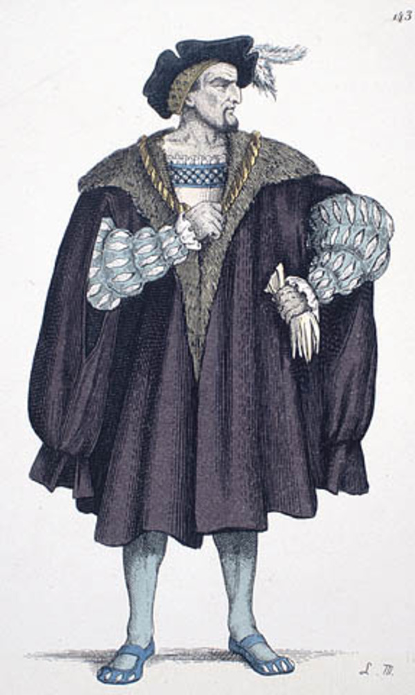
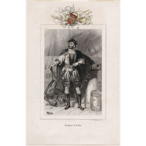
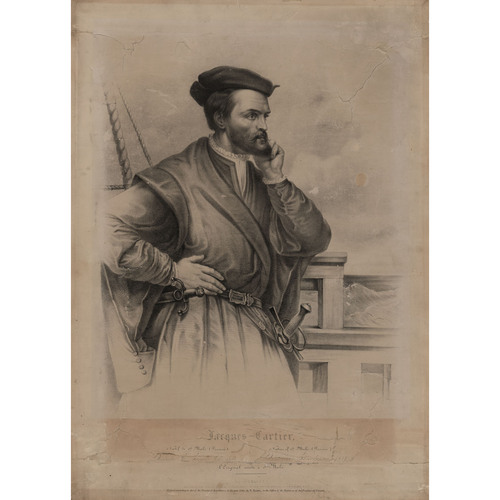
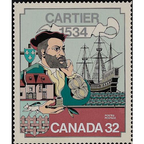
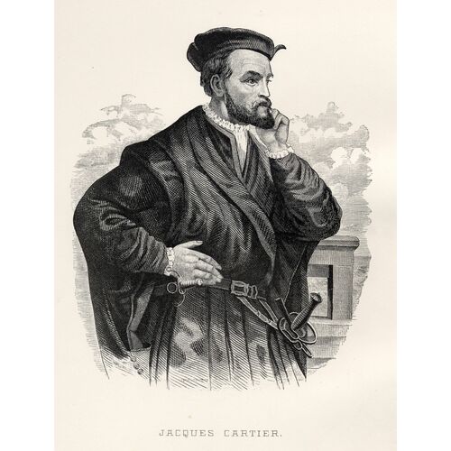
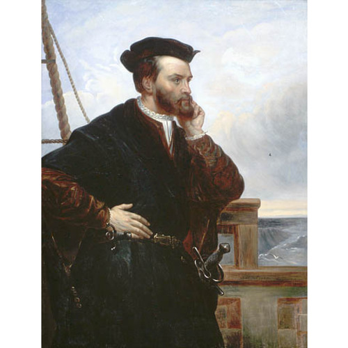
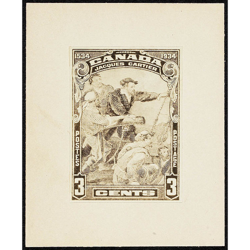
No authentic portrait of Cartier is known. According to Lanctot, who has made a special study of Cartier’s iconography, eight pictures merit attention: a sketch about two inches high on the so-called Harleian Mappemonde (the latter is attributed to Pierre Desceliers and was made after 1542); a drawing on the Vallard map of 1547; a sketch one inch high in an edition of Ramusio in 1556; a portrait published in 1836 and made by Léopold Massard after the Desceliers sketch; a portrait by François Riss in 1839, reproduced by Théophile Hamel*; a portrait published by Michelant, taken from a drawing which is said to have belonged to the BN and to have disappeared subsequently; a wooden medallion, 20 in. in diameter, dated 1704 and found in 1908 by Clarke in an old house in Gaspé; and, finally, the copy of a portrait belonging to one of the Marquis de Villefranche. Lanctot is inclined to think that the only authentic one of all these portraits is “the sketch on the Desceliers map,” the others being more or less accurate copies or even fanciful representations.
The accounts of Cartier’s voyages raise a still more awkward problem. The account of the first voyage was published initially in Italian by Ramusio in 1565, then in English by Florio in 1580, and finally in French by Raphaël du Petit-Val in 1598; it is this last text which was used by Marc Lescarbot. A manuscript preserved in the BN (no.841 of the Moreau collection) was edited by the Quebec Literary and Historical Society in 1843, by Michelant and Ramé in 1867, by H. P. Biggar in 1924, by J. Pouliot in 1934, and finally by Th. Beauchesne in 1946. But this manuscript is only a copy of an original which has today disappeared.
The account of the second voyage was published in French as early as 1545, but anonymously. The original manuscript which served for this edition has not been discovered either. Three manuscripts of the account of the second voyage have been preserved in the BN: no.5589, the best one, that published by Lescarbot and thought by Biggar to be the original; no.5644, which is faulty; no.5653, published at Quebec in 1843 and considered by Avezac to be the original. Robert Le Blant maintains in a recent study that none of the three is the original, and that all three are copies of a lost prototype.
Finally, for the account of the third voyage we possess only an incomplete English version compiled by Hakluyt in 1600, from a document which he had found in Paris around 1583 and which is now lost.
The authorship of the accounts is another problem which it has not been possible to resolve. The account of the third voyage, of which we have only the English version, gives us no indication. As for the account of the second voyage, Jehan Poullet has been suggested as the author. He was probably a native of Dol, in Brittany; he was first mentioned 31 March 1535, when he appeared before a meeting in Saint-Malo to submit the roll of the members of the next expedition. His name does not appear on this roll, but it occurs four times in the Brief récit published in 1545. It was in 1888 that Joüon Des Longrais submitted that Poullet, in view of “the obviously exaggerated importance given to him in the Brief Récit,” must have had a hand in the writing of it, and he added: “Perhaps he is the author.” In 1901 Biggar revived the same argument. Furthermore, perceiving a certain similarity of style between the accounts of the first two voyages, Biggar assumes that Poullet is also the writer of the account of the first voyage. In 1949 another hypothesis was advanced: Marius Barbeau maintained that Rabelais rewrote Cartier’s accounts to present them to the king. Bernard G. Hoffman replied that they in no way recall the style of Rabelais, that the second account must of necessity have been sent to the king not later than 1536, that Rabelais did not know of Cartier’s voyages before 1538, in short that the hypothesis was unfounded.
The problem would be simpler if the original documents could be found, and above all if one knew Cartier better. In Biggar’s view it is obvious that the accounts, such as we know them, were taken from a ship’s log kept by Cartier, and shaped into a literary story. But, argues Biggar, if Cartier could keep a ship’s log, he was incapable of producing a literary story. That Cartier did not have the necessary literary talents has, however, never been demonstrated; to prove that he had not would be as difficult as to prove that he had. For the time being the author of the accounts remains unknown and the problem persists in its entirety.
Cartier has long been hailed by French-speaking historians as the discoverer of Canada. But did Cartier discover Canada? If we understand by that term the Canada of the 16th century, that is to say the region extending from approximately the Île d’Orléans to Portneuf, it is certainly Cartier who discovered it, but in 1535. Canada however has varied in its geographical dimensions: under the French régime it was identical with the settlement of the St. Lawrence, from Gaspé to the Vaudreuil-Soulanges region; the discoverer of this Canada was still Cartier. The same area, transformed in 1763 into the province of Quebec, became the Lower Canada of 1791, and in 1840 was merged with Ontario to form United Canada; up to Confederation the region called Canada still began only at the Gaspé Peninsula. Consequently one can affirm until 1867 that Cartier was the discoverer of Canada; the French-speaking historians were still perfectly correct. But Canada had not finished its development. By the Confederation of 1867 New Brunswick and Nova Scotia were added to it. If Nova Scotia was not reached by John Cabot, it certainly was by the Corte-Reals and by Fagundes; it appears on maps long before Cartier crossed the Atlantic. Finally, since 1949, the year that Newfoundland joined Confederation, the discovery of Canada in its present form must be attributed to the Italian Cabot, who had transferred his allegiance to England.
But even if Cartier’s explorations are not on the same scale as the exploits of Hernando de Soto or of certain South American explorers, he does have a place among the great names of the 16th century. He was the first to make a survey of the coasts of the Gulf of St. Lawrence, to describe the life of the Indians of northeastern North America, and, what is most to his credit, in 1535 he discovered the St. Lawrence River, which was to become the axis of the French empire in America, the vital route which would carry eager explorers towards Hudson Bay, towards the mysterious horizon of the western sea, and towards the Mississippi. Cartier discovered one of the greatest rivers in the world, and he marks the starting-point of France’s occupation of three-quarters of a continent.
The following publications reproduce the various documents relating to Cartier known to date: Biggar, Documents relating to Cartier and Roberval. Hakluyt, Principal navigations (1903–5), VIII, 183–272 (Cartier’s three voyages). Jacques Cartier, Documents nouveaux, éd. F. Joüon Des Longrais (Paris, 1888). Precursors (Biggar). André Thevet, Les singularitez de la France antarctique, autrement nomée Amérique: & de plusieurs terres & isles découvertes de nostre temps (Paris, 1558; autre éd., Anvers, 1558; éd. Paul Gaffarel, Paris, 1878), an account which belongs among these documents.
The principal editions of Cartier’s voyages are as follows: Jacques Cartier, Bref récit; Brief récit & succincte narration . . . (Paris, 1545), reproduced by photostat in Jacques Cartier et la “grosse maladie” (XIXe Congrès international de Physiologie Pub., Montréal, 1953); Voyage de 1534; [—— et al.], Voyages de découverte au Canada, entre les années 1534 et 1542, par Jacques Quartier, le sieur de Roberval, Jean Alphonse de Xanctoigne, etc. suivis de la description de Québec et de ses environs en 1608, et de divers extraits relativement au lieu de l’hivernement de Jacques Quartier en 1535–36 (Société littéraire et historique de Québec, 1843). J.-C. Pouliot, La grande aventure de Jacques Cartier: épave bi-centenaire découverte au Cap des Rosiers en 1908 (Québec, 1934). “Voyages de Jacques Cartier au Canada,” éd. Th. Beauchesne, dans Les Français en Amérique (Julien), 77–197. Voyages of Cartier (Biggar). See also J.-E. Roy, Rapport sur les Archives de France relatives à l’histoire du Canada (PAC pub., VI, Ottawa, 1911), 669–72, which summarizes the history of the various mss of Cartier’s voyages and lists the various theories in regard to them.
Of the numerous published studies of Cartier only the most important are given here; certain of them include detailed bibliographies. These studies are listed in chronological order. N.-E. Dionne, Vie et voyages de Jacques Cartier (3e éd., Québec, 1934) (first published in 1889); Étude archéologique: le fort Jacques Cartier et la Petite Hermine (Montréal, 1891). Biggar, Early trading companies. A.-J.-M. Lefranc, Les navigations de Pantagruel (Paris, 1905). [C.-J.-F. Hénault], “Extrait de la généalogie de la maison Le Veneur . . . ,” NF, VI (1931), 340–43. Marius Barbeau, “Cartier inspired Rabelais,” Can. Geog. J., IX (1934), 113–25. Lionel Groulx, La découverte du Canada, Jacques Cartier (Montréal, 1934). Gustave Lanctot, Jacques Cartier devant l’histoire (Montréal, 1947); book reviewed by Lionel Groulx, RHAF, I (1947), 291–98. Les voyages de découverte et les premiers établissements (XVe, XVIe siècles), éd. Ch.-A. Julien, (Colonies et empires, 3e série, Paris, 1948). Hoffman, Cabot to Cartier, in particular 131–67. Robert Le Blant, “Les écrits attribués à Jacques Cartier,” RHAF, XV (1961–62), 90–103.
For the cartography of Cartier, see Marcel Trudel, Atlas historique du Canada français des origines à 1867 (Québec, 1961), cartes 14–23.
Revisions based on:
Arch. et Patrimoine d’Ille-et-Vilaine (Rennes, France), “Recherche documentaire: reg. paroissiaux et état civil,” Saint-Malo, 1519: archives-en-ligne.ille-et-vilaine.fr/thot_internet/FrmSommaireFrame.asp (consulted 21 May 2014).
Cite This Article
Marcel Trudel, “CARTIER, JACQUES (1491-1557),” in Dictionary of Canadian Biography, vol. 1, University of Toronto/Université Laval, 2003–, accessed February 12, 2026, https://www.biographi.ca/en/bio/cartier_jacques_1491_1557_1E.html.
The citation above shows the format for footnotes and endnotes according to the Chicago manual of style (16th edition). Information to be used in other citation formats:
| Permalink: | https://www.biographi.ca/en/bio/cartier_jacques_1491_1557_1E.html |
| Author of Article: | Marcel Trudel |
| Title of Article: | CARTIER, JACQUES (1491-1557) |
| Publication Name: | Dictionary of Canadian Biography, vol. 1 |
| Publisher: | University of Toronto/Université Laval |
| Year of publication: | 1966 |
| Year of revision: | 2014 |
| Access Date: | February 12, 2026 |


